The Mountain That Weighed the Earth, Burned a Fiddle, and Helped Give Us Contour Lines
In 1774, on a cloudy Scottish mountain called Schiehallion, the Astronomer Royal spent months staring up at stars to find out how much the whole planet weighs. When the work was done, the story goes, there was a party in the hut on the hillside, the hut caught fire, and the camp fiddler watched his fiddle burn. The scientist promised him a new one from London. A few years later, back at a desk, a mathematician trying to make sense of the mountain's shape started drawing faint lines that connected points of the same height.
By the Curiosities Desk · · 5 min read · Filed under Physics · Today’s round
What happened: Schiehallion in 1774
The question was an old one. Isaac Newton had argued that everything with mass pulls on everything else, so a big enough mountain should tug a hanging plumb line slightly sideways. In his Principia he considered the idea but doubted a real mountain could pull hard enough to measure. If someone could measure it, though, they could compare the mountain’s pull with the Earth’s pull and work out how dense the Earth is, and so, in effect, weigh it.
In 1772 Nevil Maskelyne, the fifth Astronomer Royal, proposed trying. The Royal Society set up a “Committee of Attraction,” whose members included Joseph Banks and Benjamin Franklin. The money came from funds left over from the Society’s 1769 transit of Venus expeditions, which King George III had handed to the Society.
The Society sent the surveyor Charles Mason to find a suitable mountain. In the summer of 1773 he recommended Schiehallion in Perthshire, a 1,083-meter peak that stands fairly alone and runs roughly east to west, so its north and south sides make clean measuring stations. Mason then declined to do the fieldwork himself at the offered rate of a guinea a day. So Maskelyne went.
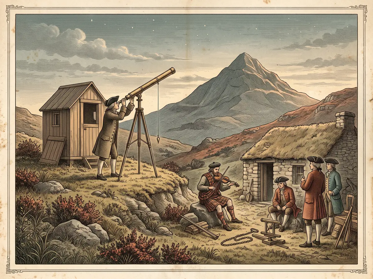
In the summer of 1774, Maskelyne set up observatories on the south and north slopes. The trick was clever. At each station, he used a long telescope called a zenith sector to measure exactly where certain stars passed overhead. A plumb line defines “straight down,” so if the mountain pulled the line toward itself, the stars would appear slightly shifted. Measuring from both sides doubled the effect. Across the two stations, he made 337 observations.
The stars said the two stations were 54.6 arcseconds apart in latitude. (An arcsecond is 1/3,600 of a degree.) A careful ground survey said the true difference was 42.94 arcseconds. The gap, 11.6 arcseconds, was the mountain’s pull. That is roughly the angle a coin makes when viewed from a few hundred meters away, and Maskelyne had caught it.
In 1775 he reported to the Royal Society that the Earth’s mean density was “at least double of that at the surface,” and he received the Society’s Copley Medal.
Then comes the part no official report mentions. According to local tradition, the end of the work was marked with a celebration at the hillside bothy (a simple hut), the bothy burned down, and the fiddle of Duncan “Redhair” Robertson, a local man who cooked for and entertained the camp, was lost. Maskelyne is said to have sent him a new fiddle from London, and Robertson is said to have written a tune about it, “The Yellow London Lady.” The Royal Society’s own archivist has described the episode as folklore missing from the Society’s records. A fiddle the Robertson family says is that replacement is displayed today at the Clan Donnachaidh Museum near Pitlochry.
Why it was strange: Schiehallion in 1774
Nobody could put the Earth on a scale. The experiment worked because a mountain is something you can actually measure: its height, its outline, and roughly what rock it is made of. If you know how much a hill weighs and how hard it pulls, you can scale up to the planet under it.
But that only works if you know the mountain’s shape in detail, which is where the job left the hillside. The surveying ran until 1776, and the calculations fell to Charles Hutton, a self-taught mathematician from Newcastle. He had to split Schiehallion into many imaginary columns and estimate each one’s height and pull. To organize a mess of survey points, he joined spots of equal height with faint lines. Suddenly the hill’s form jumped out of the numbers.
Maskelyne also played a part in another great measurement story, told in The Self-Taught Carpenter Who Solved the Deadliest Problem in Ocean Navigation.
What scientists learned: Schiehallion in 1774
Hutton’s paper, read to the Royal Society on May 21, 1778, assumed the mountain’s rock was about 2.5 times as dense as water and concluded the Earth’s mean density was about 4.5 times that of water. The modern value is about 5.5. Hutton was within 20 percent, from a hill and a set of plumb lines.
The big lesson was that the inside of the Earth must be much denser than the rock on its surface, a strong hint that the planet has a heavy core. It was also a convincing demonstration that Newton’s law of gravity applies to ordinary objects like mountains, not just to planets. Twenty years later, Henry Cavendish measured the same quantity in a shed with lead balls and got about 5.45, as told in The Scientist Who Weighed the Earth but Couldn’t Speak to His Housekeeper.
How it reaches us today: Schiehallion in 1774
Open almost any hiking map and you’ll see Hutton’s idea: contour lines, the wavy rings that join points of equal elevation. Close rings mean steep ground; wide ones mean gentle slopes.
He did not invent the concept alone. Dutch surveyors drew lines of equal water depth as early as 1584, Philippe Buache used them on a 1752 chart of the English Channel, and a 1746 map of the Duchy of Modena used them on land. But Hutton’s Schiehallion work is often cited as a key early use of contours on land, and a 2019 study by cartographers trying to reconstruct his work notes that no contour map of the mountain from the project survives. By about 1843, when Britain’s Ordnance Survey began recording contours regularly, they were in general use. For more ordinary things with odd beginnings, browse The Ordinary Object With the Strange Origin.
Fun fact: Schiehallion in 1774
Charles Mason, the man who picked Schiehallion, is the same Mason who had recently helped survey the Mason–Dixon line in America. He turned down running the experiment over the pay.
Sources: Schiehallion in 1774
- Nevil Maskelyne, “An Account of Observations Made on the Mountain Schehallien for Finding Its Attraction”, Philosophical Transactions of the Royal Society 65 (1775).
- Charles Hutton, “An Account of the Calculations Made from the Survey and Measures Taken at Schehallien”, Philosophical Transactions of the Royal Society 68 (1778); manuscript record, Royal Society Archives.
- Virginia Mills, “A Song of Schiehallion”, Royal Society blog, August 16, 2022.
- Karen Rann, David Fairbairn, and Ella Southern, “Reconstructing the Lost Contours of Charles Hutton”, Abstracts of the International Cartographic Association 1 (2019).
- MacTutor History of Mathematics, “Nevil Maskelyne Measures the Earth’s Density”, University of St Andrews.